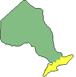
Ontario is a province in the country of Canada. One of ten provinces and three territories. Not all of the provinces and territories are divided in the same way so if researching one it's best to take a little time to learn a bit about its geography and history.
Ontario did not get its present name until 1867, but to avoid confusion it will be referred to by its present name as needed. For more see 'A Brief Historical Timeline of Ontario'.
The Constitutional Act, aka the Canada Act, on 10 Jun 1791 divides the colony of Quebec into Upper Canada (land west of the Ottawa River) and Lower Canada (land east of the Ottawa River) and establishes English Law and land tenure in Upper Canada.
The Act of Union on 10 Feb 1841 unites Upper and Lower Canada as the province of Canada. Upper Canada is renamed Canada West (Lower Canada becomes Canada East).
The three provinces of British North America (Canada, Nova Scotia & New Brunswick) are united in Confederation. The province of Canada becomes two new provinces - Ontario and Quebec.
Ontario was first divided into four districts which were established 24 July 1788:
Comprised of the counties of Brant, Bruce, Dufferin, Elgin, Essex, Grey, Huron, Kent, Lambton, Middlesex, Norfolk, Oxford, Perth, Waterloo, and Wellington. Renamed Western District.
Comprised of the counties of Durham, Haldimand, Haliburton, Halton, part of Hastings, Lincoln, Muskoka, Nipissing, Northumberland, Parry Sound, Peel, Peterborough, Simcoe, Welland, Wentworth, Victoria, and York. Renamed Home District.
Comprised of the counties of Frontenac, part of Hastings, Lanark, part of Leeds, Lennox & Addington, Prince Edward, and Renfrew. Renamed Midland District.
Comprised of the counties of Carleton, Dundas, Glengarry, Grenville, part of Leeds, Prescott, Russell, and Stormont. Renamed Eastern District.
In 1791 Upper Canada was divided into nineteen counties within four districts which were renamed to Western, Home, Midland, and Eastern. Between 1791-1849 these four districts were divided into new smaller districts, some comprised of several counties, others with just one.
In 1849 all the districts were abolished in favour of the country structure. Counties were divided into townships, and the townships into concessions and lots. Lots could then sold or granted as is, or further divided into parcels for sale.
By the 1920's Ontario was comprised of 41 counties and 11 districts (different than the early Upper Canada districts, these newer districts operated similarily to counties). The areas in green are counties, the blue are districts.
This shows a typical county as divided into several townships. Each township might operate independently, or may be part of a larger municipality.
Within each township there are numbered line roads which run in a common direction and numbered concession roads which run (usually) at right angles to the line roads. The exact location of an individual property can be determined by its Lot Number and the Number of the Line Road or Concession Road running across the front of the property -- usually a Concession Road.
Addington County
Algoma District
Bothwell County
Brant County
Bruce County
Cardwell County
Carleton County
Cochrane District
Dufferin County
Dundas County
Durham County
Elgin County
Essex County
Frontenac County
Glengarry County
Grenville County
Grey County
Haldimand County
Haliburton County
Halton County
Hastings County
Huron County
Keewatin, District of
Kenora District
Kent County
Lambton County
Lanark County
Leeds County
Lennox & Addington County
Lennox County
Lincoln County
Manitoulin District
Middlesex County
Monck County
Muskoka District
Nipissing District
Norfolk County
Northumberland County
Ontario County
Ontario County #1
Oxford County
Parry Sound District
Peel County
Perth County
Peterborough County
Prescott County
Prince Edward County
Rainy River District
Renfrew County
Rupert's Land
Russell County
Simcoe County
Stormont County
Sudbury District
Suffolk County
Thunder Bay District
Timiskaming District
Victoria County
Waterloo County
Welland County
Wellington County
Wentworth County
York County
Not sure which county or district a town or village is in? Use the Ontario Locator.
For maps: The Canadian County Atlas Digital Project is an excellent resource with lot/concession maps of Ontario as it existed 1874-1881, and the Ontario government's topographical maps offers current maps.